

Description
Humminbird Coastmaster East Chart Premium Australia East
For an added angling advantage, opt for Humminbird CoastMaster Premium Marine Charts.
Note this is a map not a screen..
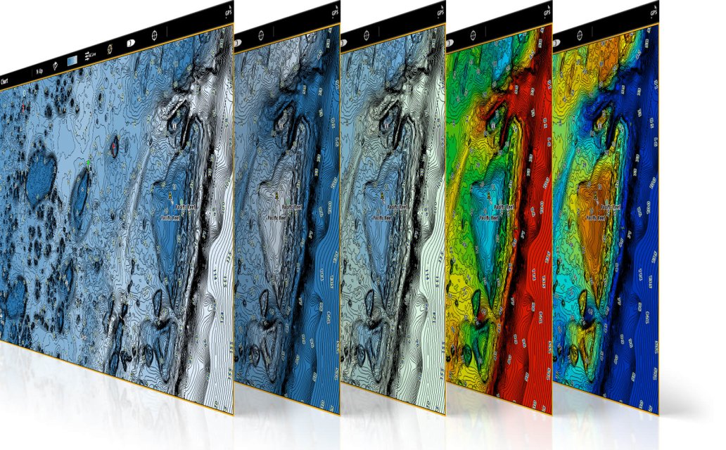
These charts include region-specific coverage and all the features of CoastMaster, with a few key additions: 2D Shaded Relief, Enhanced Aerial Imaging, Auxiliary Contours and Bottom Hardness Layers.
- 2D Shaded Relief – Makes bottom detail and depth changes easy to spot
- Enhanced Aerial Imagery– Navigate confidently and find new fishing spots
- Auxiliary Contours– Provides additional contours in shallow water areas
- Bottom Hardness – Helps anglers identify bottom composition and key fish-holding areas
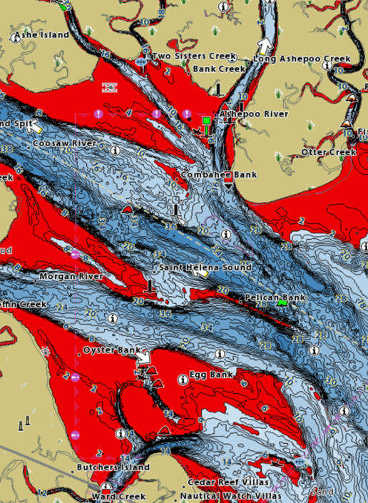
COMPLETE COASTAL COVERAGE
We’ve got you covered with never before seen detail of the Australian coastline. Always know where you are and what’s ahead with full chart detail of the entire Australian coastline as well as over numerous lakes throughout the country.
|
VX TECHNOLOGY Don’t delay. VX technology provides five customisable colour palettes and fast map load times, so you can seize every moment on the water. |
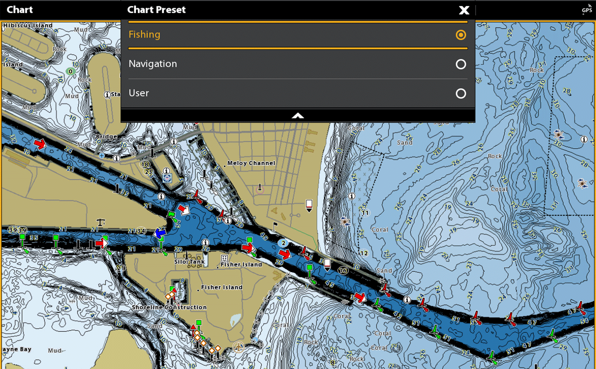
CHART VIEWS See the world your way with three chart view presets. Individually customise Fishing, Navigation and User presets to quickly cycle between your favourite settings for specific fishing scenarios. Spend less time with settings, and more time setting the hook. |
 |
 |
|
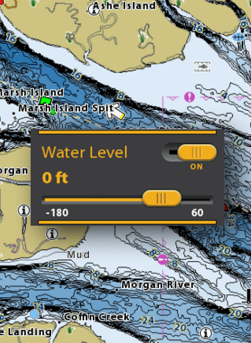
TIDES AND CURRENTS
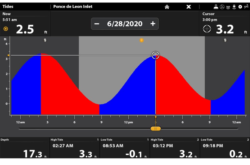
Whichever way the tide rolls, make sure it’s in your favour. CoastMaster’s predictive software allows you to plan your fishing day with tidal direction and height, as well as the speed and direction of currents and more, so you’ll never be caught guessing.
|
 |
INDUSTRY - LEADING COASTMASTER FEATURES
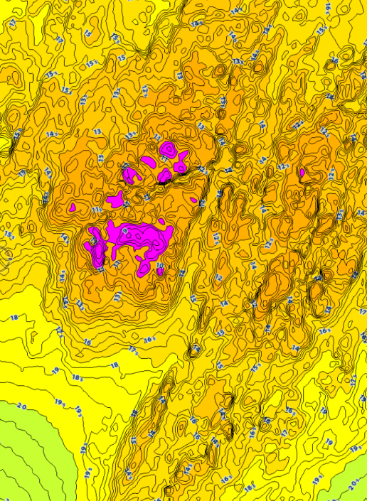
DEPTH HIGHLIGHTCreate up to four user-defined depth highlight ranges, so you can easily target productive water and stay in the bite zone. |
|
 |
 |
 |
 |
NAVIGATE WITH CONFIDENCE
2 Reviews
-
HUMMINBIRD COASTMASTER EAST CHART PREMIUM AUSTRALIA
All good, and they will let you know if it is in stock or has to be ordered.
-
Contour data
Very limited contour data for my area


 - Australia North East")