

Description
Humminbird CoastMaster Chart Standard Australia
We’ve got you covered with never before seen detail of the Australian coastline. Always know where you are and what’s ahead with full chart detail of the entire Australian coastline as well as over numerous lakes throughout the country.
Features
- VX TECHNOLOGY
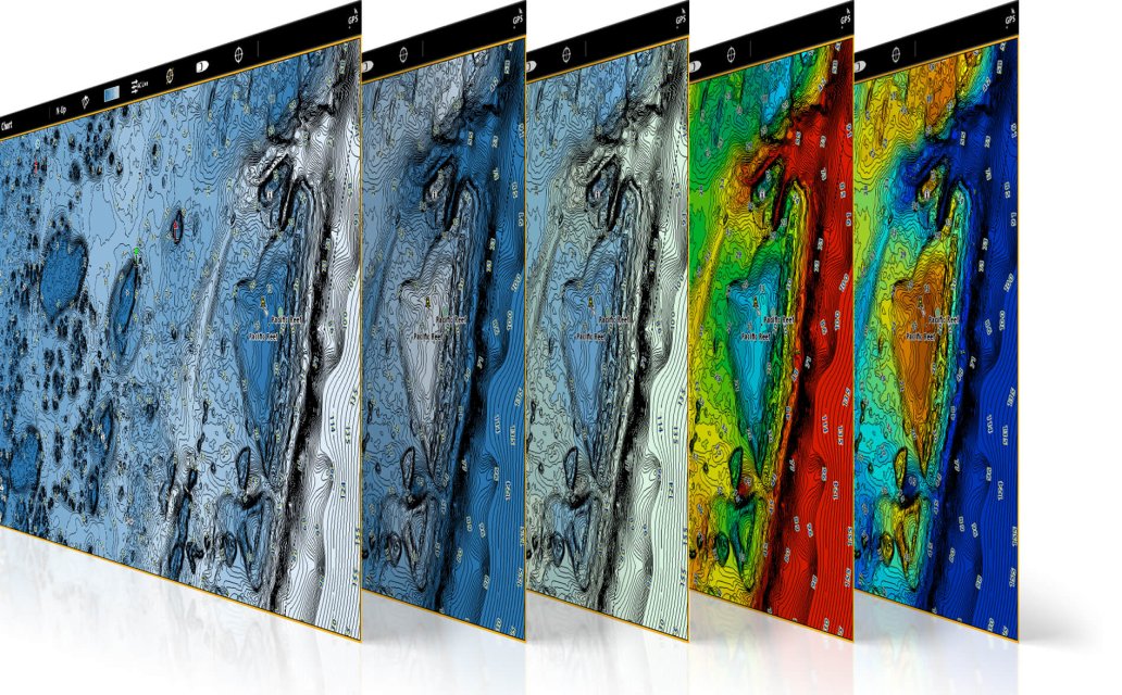
Don’t delay. VX technology provides five customisable colour palettes and fast map load times, so you can seize every moment on the water. - DEPTH HIGHLIGHT
Create up to four user-defined depth highlight ranges, so you can easily target productive water and stay in the bite zone. - SHALLOW WATER HIGHLIGHT
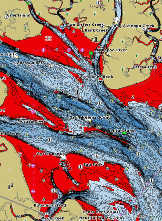
Navigate safely and quickly identify spots where fish are hiding with red shading highlights for shallow water areas on an adjustable range from zero to 30 feet. - WATER LEVEL OFFSET
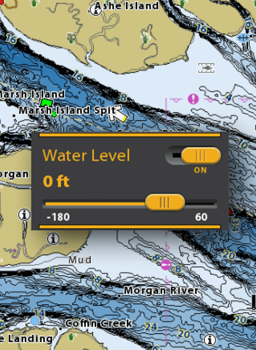
Synchronize the depth contours and shorelines of your CoastMaster charts with the actual water levels, so that your chart will reflect the current water level of your fishing spots. - NAVIGATE WITH CONFIDENCE
In addition to exclusive features designed for saltwater fishing, CoastMaster gives you access to a wealth of navigational data to make your next trip safe and successful. View navigation aids, artificial reefs, points of interest, and marina information.
Complete coastal coverage
We’ve got you covered with never before seen detail of the Australian coastline. Always know where you are and what’s ahead with full chart detail of the entire Australian coastline as well as over numerous lakes throughout the country.
Note this is a map not a screen..
|
VX TECHNOLOGY Don’t delay. VX technology provides five customisable colour palettes and fast map load times, so you can seize every moment on the water. |
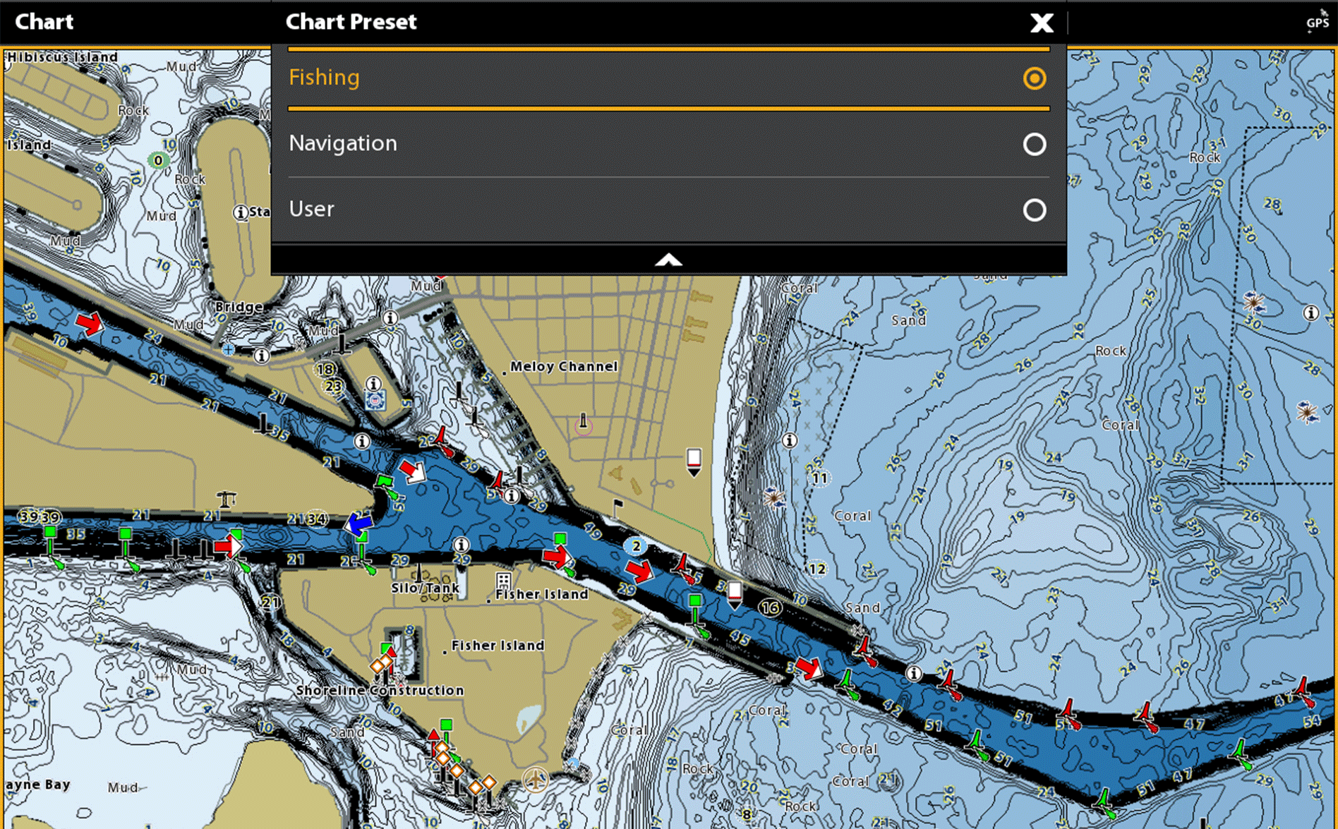
CHART VIEWS See the world your way with three chart view presets. Individually customise Fishing, Navigation and User presets to quickly cycle between your favourite settings for specific fishing scenarios. Spend less time with settings, and more time setting the hook. |
 |
 |
|
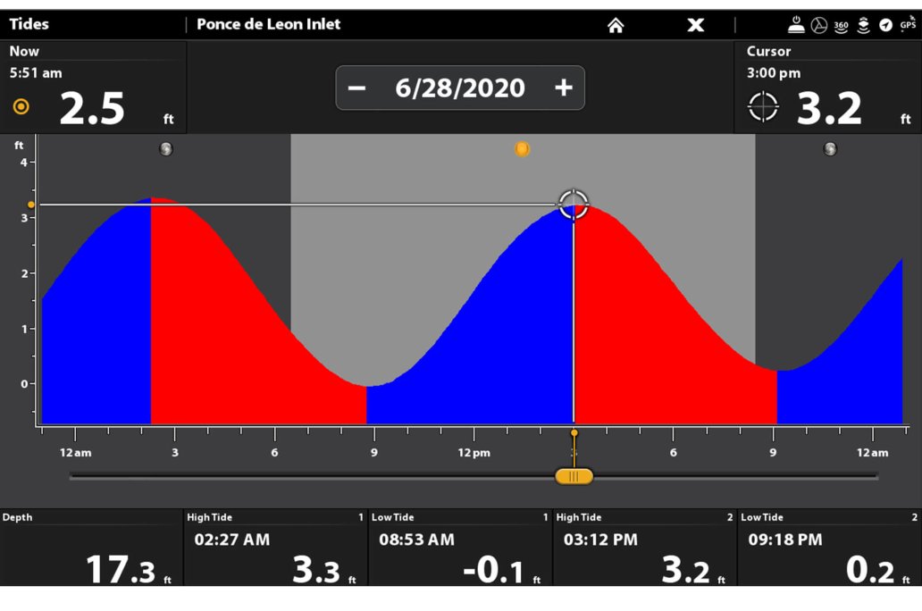
TIDES AND CURRENTS
Whichever way the tide rolls, make sure it’s in your favour. CoastMaster’s predictive software allows you to plan your fishing day with tidal direction and height, as well as the speed and direction of currents and more, so you’ll never be caught guessing.
|
 |
INDUSTRY - LEADING COASTMASTER FEATURES
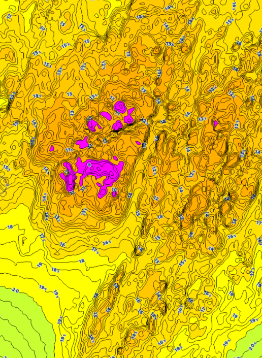
DEPTH HIGHLIGHTCreate up to four user-defined depth highlight ranges, so you can easily target productive water and stay in the bite zone. |
|
 |
 |
 |
 |
NAVIGATE WITH CONFIDENCE


")
")